Connectivity Through Pastures in Albania
This project was implemented by the Resource Environmental Center Albania (REC) from November 2023 to October 2025.

Challenge
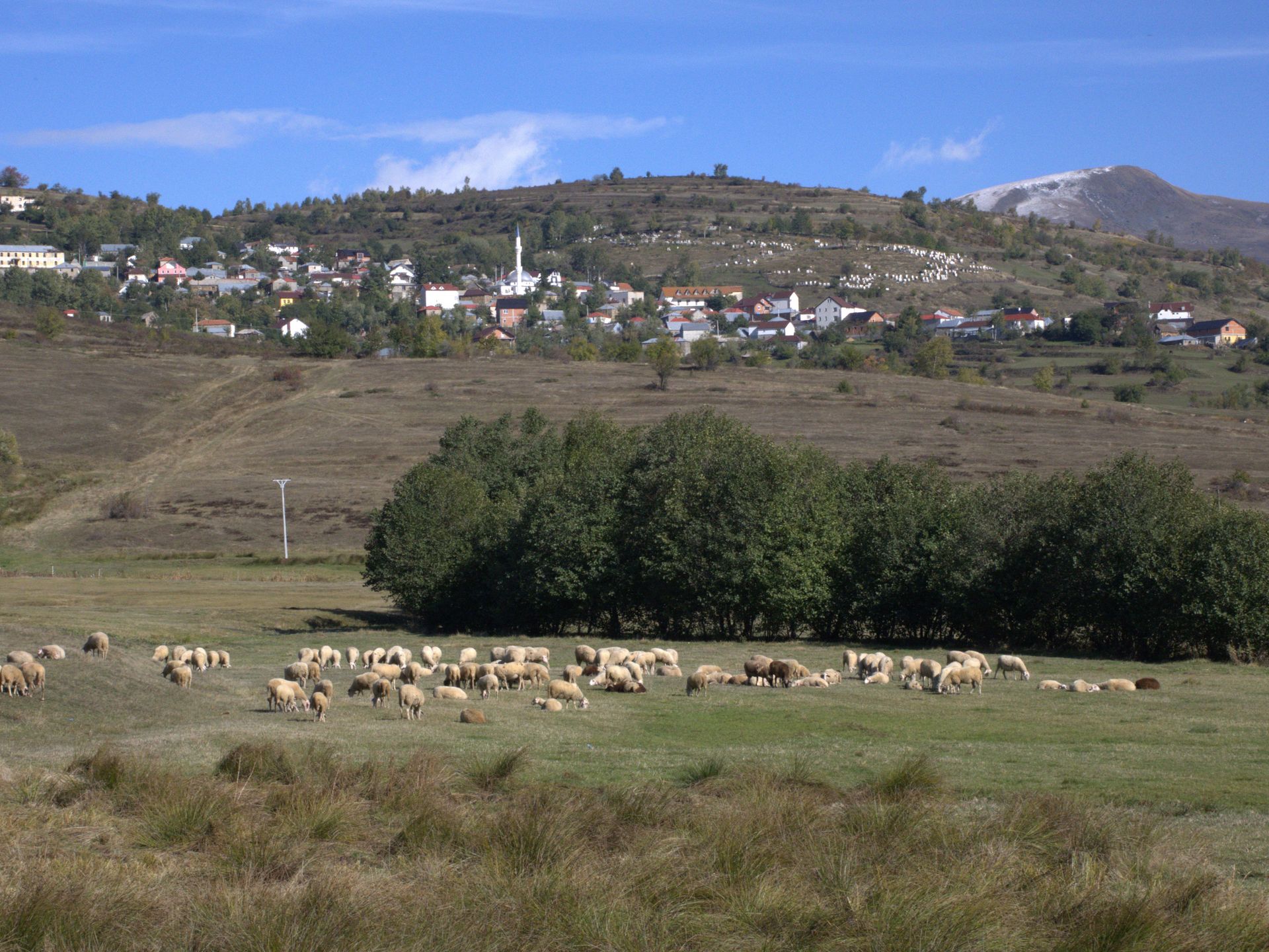
The high pastures of Korab–Koritnik are losing both people and biodiversity. As shepherds leave, under-grazed slopes are invaded by shrubs and erosion scars increase. Climate change and unclear institutional responsibilities further weaken management, while unique species and habitats along the Albanian section of the European Green Belt remain poorly documented and protected.
Objective
The project aimed to create a solid evidence base for sustainable pasture management and to turn that knowledge into concrete decisions. The project wanted to map pastures and habitats, understand the social and economic drivers of change, and provide relevant institutions with clear recommendations and tools to guide grazing, reduce erosion and strengthen biodiversity conservation.
Approach
The project combined science, local knowledge and policy work:
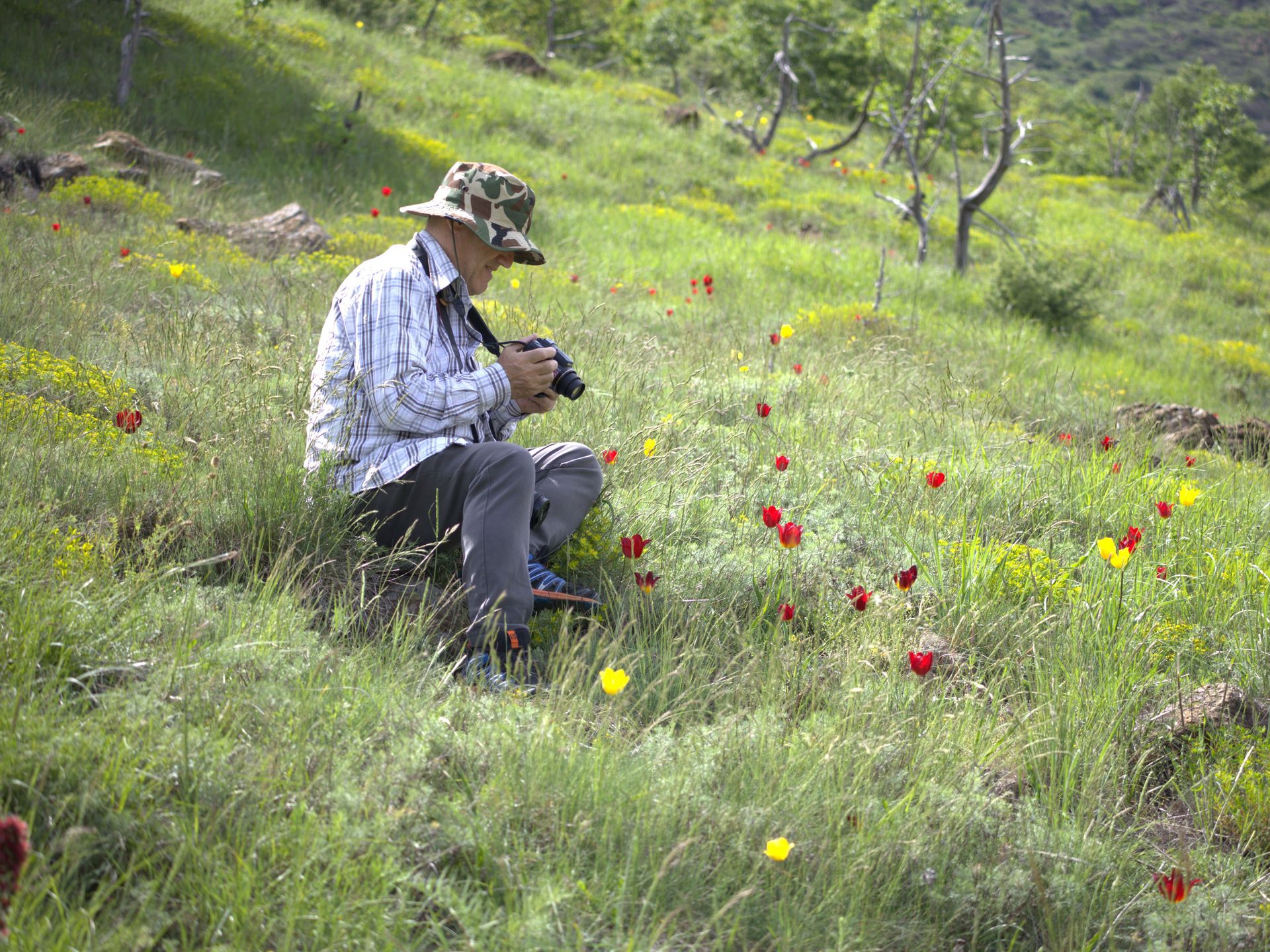
- Field and remote sensing: Botanists, an ecosystem ecologist and a GIS expert mapped vegetation and pastures using satellite imagery, drones and on-the-ground surveys.
- Community insight: A local social expert interviewed shepherds and families about grazing practices, challenges and needs.
- Policy integration: Findings were turned into recommendations and a concise policy paper, and were discussed with the National Agency of Protected Areas, the National Forest Agency and the Regional Administration of Protected Areas in dedicated meetings and a national workshop.
Achieved Results
The project provided authorities with a complete pasture and habitat map and a structured pasture inventory for Korab–Koritnik, together with an integrated set of recommendations on sustainable management. An entirely new subpopulation of the critically endangered Tulipa albanica was discovered and, based on this, NAPA received a formal proposal to expand its protected area. A policy paper on pasture management and future strategy options was submitted to the National Agency of Protected Areas, the National Forest Agency and the Regional Administration of Protected Areas.
BESTbelt project poster

REC_Connectivity_through_pastures.jpg
Download (7 MB)Project video
Connectivity Through Pastures
The project was implemented in the municipalities of Kukës and Dibër, Albania.
Nearest city: Tirana
Project lead: Resource Environmental Center in Albania (REC)
Rr. “Ismail Qemali”, No. 27, 1001
Tirana, Albania
Grant: 38.982,24 €
Duration: 24 months
Contact person for the BESTbelt project: Ani Ahmetaj, manager(at)recshqiperi.org
Website: https://recshqiperi.org/
Interactive Map
This map is currently hidden to protect your privacy. When you click the button below, the map will be loaded from Mapbox.
If you tick the checkbox, this selection will be saved in a cookie and the map will be displayed automatically the next time you visit the site.